Opened 8 years ago
Closed 8 years ago
#1409 closed task (fixed)
Test nectdf import + export
| Reported by: | Vlad Merticariu | Owned by: | Bang Pham Huu |
|---|---|---|---|
| Priority: | major | Milestone: | 9.3 |
| Component: | rasserver | Version: | development |
| Keywords: | Cc: | Andrei Badoi, Dimitar Misev, Bang Pham Huu | |
| Complexity: | Medium |
Description
Task is:
- download the attached netcdf file and inspect them in a netcdf client (e.g. panoply)
- import the netcdfs into rasdaman (either 1 band at a time, or several bands)
- export the data from rasdaman in png and netcdf
- inspect the results using the same client, check that the files resulting from rasdaman are the same as the original
Examples on how to import netcdf data in rasaman can be found in systemtests/testcases_mandatory/test_netcdf
Attachments (3)
Change History (16)
comment:1 by , 8 years ago
comment:2 by , 8 years ago
Here's some more sample data: https://rsg.pml.ac.uk/shared_files/olcl/data_for_vlad/
Incl. wcst_import ingredients :
- this is a multi band insitu : http://pastebin.com/C9bhSiB7
- this is a single band insitu : http://pastebin.com/HCyQc3W7
comment:3 by , 8 years ago
| Cc: | added |
|---|---|
| Milestone: | → 9.3 |
comment:4 by , 8 years ago
| Owner: | changed from to |
|---|---|
| Status: | new → assigned |
I see there is a patch for this ticket was uploaded in patch manager and it was failed. The change in this patch with calculation of the Lat (negative direction) leads to different subsets (netCDF is top and PNG is bottom).
http://rasdaman.org/attachment/ticket/1409/upsize_down.png
So I'll take this ticket and check it a bit more careful, thanks Drusu for doing it first.
comment:5 by , 8 years ago
So the problem with the reversed image is invalid, sorry, (because the netcdf was flipped then I saw wrong direction, checked by Vlad).
There is a problem now is the netCDF when do subsets (e.g: Lat(-45:45) is missing value 0, then it is shifted by 1 pixel).
e.g: subsets
45, 35, 25, 15, 5, -5, -15, -25 ;
e.g: the unsubsetted result:
90, 80, 70, 60, 50, 40, 30, 20, 10, 0, -10, -20, -30, -40, -50, -60, -70, -80 ;
by , 8 years ago
| Attachment: | netcdf_mirror.png added |
|---|
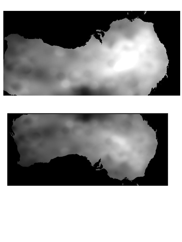
comment:6 by , 8 years ago
@Vlad: if we write the Lat axis top-down (90, 88, … -90) it will be mirrored in Panoply. If write bottom up (-90, -88, … 90) then it display correctly.
http://rasdaman.org/attachment/ticket/1409/netcdf_mirror.png
comment:7 by , 8 years ago
It doesn't matter. As you see in the left-hand side image, panoply believes that the north pole is at -90 degrees, which is false.
Bottom up is correct for linear negative axes.
comment:8 by , 8 years ago
Yes, but in the patch for this ticket it writes top-down (which is in the right-hand side image), then I fixed it to write bottom-up (left-hand side image), you see in both case Panoly displays bottom-up (North is -90 degree in axis number).
maybe I'm confusing with the axis, sorry.
follow-up: 10 comment:9 by , 8 years ago
The way the image is written by the patch is correct.
Right-hand side = correct
Left-hand side = incorrect
comment:10 by , 8 years ago
Replying to vmerticariu:
The way the image is written by the patch is correct.
Right-hand side = correct
Left-hand side = incorrect
yeah, I just realize what you meant after comment, you are rightthanks.
by , 8 years ago
| Attachment: | diffrent_netcdfs.png added |
|---|
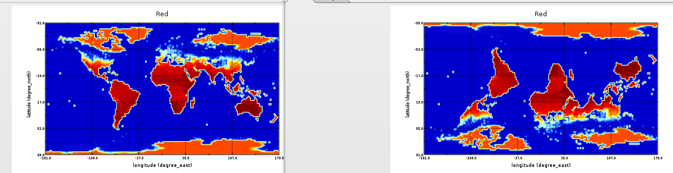
comment:11 by , 8 years ago
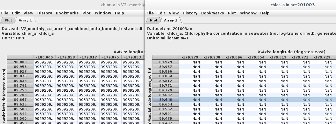
I imported the file http://flanche.net/geodata/nc-201003.nc with this recipe http://pastebin.com/C9bhSiB7
then compare in Panoply (left is encoded netCDF output, right is the input file). There are different
http://rasdaman.org/attachment/ticket/1409/diffrent_netcdfs.png
+ the left image is shifted by 0.21 degree.
+ the left image null value should be -999999 and in recipe set nilValue.
+ also it has an extended bound > -90 (Lat) and > 180 (Long), (not sure it was fixed).
    Lat (measured in degree ) with domain extent from -123.33333333347065 to 90.00000000003335.

    Long (measured in degree ) with domain extent from -180.00000000033336 to 203.99999999997385.
comment:12 by , 8 years ago
@Vlad: in http://rasdaman.org/ticket/1409#comment:5 I meant it missed the 0 value, actually, due to the formula current in NetCdfDecodeFactory:
for (i = 0l i < points; i++) {
 if (axisDirection > 0)
     coord = geoDomMax.subtract(resolution * i)
 else
     coord = geoDomMin.add(resolution * i)
}
So if I have a coverage with offset vector is (Long: 10,Lat:-10) and bounding box: (Lat: -90: 90, Long: -180:180), then I subset: Lat(-20:15), it returns a coverage with data: Lat = 15, 5, -5 ;
this is wrong coordinates and what need to do is shifted the input subset to correct geo coordinate (http://codereview.rasdaman.org/D249, wait for your review), so Lat(-20:15) will be shifted to (-20:20) and the netCDF formula above will return data: Lat = 20, 10, 0, -10 ; which is correct points.
netcdf file can be found here:
http://flanche.net/geodata/nc-201003.nc
http://flanche.net/geodata/nc-201004.nc